


Groton 8 Voting District, New London County, Connecticut
About
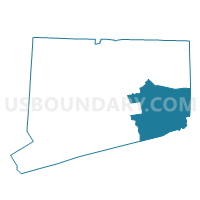
Outline

Summary
| Unique Area Identifier | 550110 |
| Name | Groton 8 Voting District |
| County | New London County |
| State | Connecticut |
| Area (square miles) | 8.70 |
| Land Area (square miles) | 5.08 |
| Water Area (square miles) | 3.62 |
| % of Land Area | 58.44 |
| % of Water Area | 41.56 |
| Latitude of the Internal Point | 41.33000670 |
| Longtitude of the Internal Point | -72.00264860 |
Maps


Graphs
Select a template below for downloading or customizing gragh for Groton 8 Voting District, New London County, Connecticut


Neighbors
Neighoring Voting District (by Name) Neighboring Voting District on the Map
- Voting District 1000001, Suffolk County, NY
- Groton 1 Voting District, New London County, CT
- Groton 5 Voting District, New London County, CT
- Groton 6 Voting District, New London County, CT
- Groton 7 Voting District, New London County, CT
- Stonington 4 Voting District, New London County, CT
Top 10 Neighboring County Subdivision (by Population) Neighboring County Subdivision on the Map
- Groton town, New London County, CT (40,115)
- Southold town, Suffolk County, NY (21,968)
- Stonington town, New London County, CT (18,545)
Top 10 Neighboring Place (by Population) Neighboring Place on the Map
- Old Mystic CDP, CT (3,554)
- Noank CDP, CT (1,796)
- Poquonock Bridge CDP, CT (1,727)
- Groton Long Point borough, CT (518)
Top 10 Neighboring Unified School District (by Population) Neighboring Unified School District on the Map
- Groton School District, CT (40,115)
- Stonington School District, CT (18,545)
- Fishers Island Union Free School District, NY (236)
Top 10 Neighboring State Legislative District Lower Chamber (by Population) Neighboring State Legislative District Lower Chamber on the Map
- Assembly District 1, NY (149,382)
- State House District 43, CT (23,842)
- State House District 40, CT (22,997)
- State House District 41, CT (21,212)
Top 10 Neighboring State Legislative District Upper Chamber (by Population) Neighboring State Legislative District Upper Chamber on the Map
Top 10 Neighboring 111th Congressional District (by Population) Neighboring 111th Congressional District on the Map
Top 10 Neighboring Census Tract (by Population) Neighboring Census Tract on the Map
- Census Tract 7021, New London County, CT (4,496)
- Census Tract 7028, New London County, CT (4,079)
- Census Tract 1702.02, Suffolk County, NY (4,029)
- Census Tract 7030, New London County, CT (3,919)
- Census Tract 7053, New London County, CT (3,540)
- Census Tract 7029, New London County, CT (2,473)
- Census Tract 9901, New London County, CT (0)